Sargassum Season in the Riviera Maya: When It Hits and Where to Go
In this guide
- When sargassum season actually runs
- Which parts of the coast get hit hardest
- How to check sargassum before you commit
- Where to go instead when the beach is covered
- Sargassum and the rest of your planning
- What to do on the beach if seaweed is there
- What authorities and hotels are doing
- A short decision checklist
- Bottom line
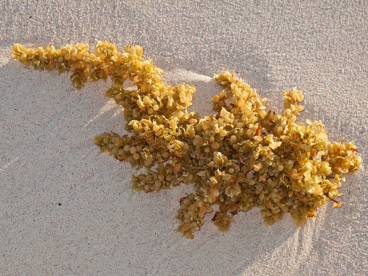
Sargassum, the floating brown seaweed that piles up on Caribbean beaches, shows up on the Riviera Maya coast roughly from April to October, with the heaviest weeks usually in June, July and August. The cleanest months tend to be November through March. Conditions vary from beach to beach and from day to day, so the practical plan is to check current reports, keep a fallback day in your itinerary, and know which places escape the worst of it.
When sargassum season actually runs
The seaweed forms in a huge band across the Atlantic and drifts west into the Caribbean on currents and wind. Scientists at the University of South Florida track it by satellite, and NASA’s Earth Observatory described the pattern in July 2026: the Atlantic belt reached its annual peak in June, ranked as the second-highest year on record behind 2025, and the Caribbean Sea and the Gulf of Mexico both set records for June. NASA noted that the trend has been building since 2011 and that biomass fell through July.
For travellers, the useful pattern looks like this:
| Months | What to expect | Notes |
|---|---|---|
| December to March | Usually the cleanest water | Peak tourist season and highest prices |
| April to May | Arrivals begin, building through May | Tulum and Playa del Carmen are commonly hit first |
| June to August | Heaviest period, often daily arrivals | Mid-summer is also the hottest, wettest time |
| September to October | Easing, but still unpredictable | Peak hurricane season; see our hurricane guide |
| November | Usually clearing | A shoulder month with lower prices |
A USF outlook reported in late July 2026 said amounts in most regions would keep decreasing in the coming months, possibly until November. Treat that as a trend, not a promise. A calendar from a commercial monitoring site puts the season at April to October and calls December and January the most reliable months, which matches what the satellite data suggest, but it is a rule of thumb rather than an official forecast.
2026 has been an unusually heavy year. Mexican coverage from May described it as shaping up to be one of the most intense since the massive arrivals of 2015, with authorities expecting to collect about 119,000 tonnes in Quintana Roo against about 96,000 in 2025. That number is a forecast by officials quoted in the news, not a measured outcome, but it explains why you saw more reports this year. Our guide to the best time to visit the Riviera Maya puts sargassum alongside weather, crowds and prices.
Which parts of the coast get hit hardest
Geography matters more than the calendar once the season is underway. The Quintana Roo coast faces east into the Caribbean, so mainland beaches take the brunt, while sheltered spots do better.
- Southern Quintana Roo (Mahahual, Xcalak): The N+ report named the south, particularly Mahahual and Xcalak, as the most affected area in 2026.
- Tulum, Akumal, Playa del Carmen: East-facing and exposed. Mexican press reporting in May 2026 cited records of 200 to 250 tonnes a day collected in Playa del Carmen and 60 to 80 tonnes a day in Cancun. Our Tulum guide and Playa del Carmen guide explain how those towns work around it.
- Puerto Morelos and Cancun’s south: Frequently affected in the heavy months.
- North Cancun and the Hotel Zone: The north-facing Hotel Zone beaches usually fare better than the east-facing ones. Not immune.
- Isla Mujeres (Playa Norte), Cozumel’s west coast: The usual escape routes because they sit in the lee of the island or face away from the incoming drift. See the section below.
The Red de Monitoreo del Sargazo’s site lists 18 monitored beaches in Cancun, 18 in Cozumel, 13 in Playa del Carmen and 10 in Tulum, plus smaller numbers in Isla Mujeres, Holbox, Costa Mujeres, Puerto Morelos and Puerto Aventuras. That makes it a good first stop for a specific beach.
How to check sargassum before you commit
No single source is perfect, so combine two or three.
- NOAA/AOML and USF Daily Sargassum Inundation Risk. The daily map classifies shoreline risk into four levels: low (blue), warning (yellow), medium (orange) and high (red), with black meaning insufficient data. It also lets you download a PDF or KMZ file for the Caribbean and Gulf.
- USF monthly outlook. The Satellite-based Sargassum Watch System page links to a bulletin each month, which tells you whether the near future looks heavier or lighter than usual.
- Red de Monitoreo del Sargazo. Sargazo.info and its social accounts publish beach-by-beach reports and photos from a citizen-science network. Quality depends on recent contributions, so look at the date on each report.
- Your hotel, a beach club, or a local tour operator. Ask what the beach looked like this morning, not last week.
A map tells you what is offshore, and a photo tells you what is on the sand now. A trip can be fine one day and rough the next, so avoid committing to a single beach day if you can help it.
Where to go instead when the beach is covered
You do not have to give up the day. These alternatives are not on the open sea or sit in the lee of an island.
| Alternative | Why it works | Guide |
|---|---|---|
| Cenotes | Inland freshwater, not affected by seaweed | Best cenotes and Gran Cenote |
| Isla Mujeres, Playa Norte | Faces north and west; usually among the cleaner beaches, though not immune | Isla Mujeres day trip |
| Cozumel west coast | Sheltered from the east-coast drift, with calm snorkeling | Cozumel ferry guide |
| Bacalar Lagoon | A freshwater lagoon inland, not on the sea | Bacalar day trip |
| Ruins and towns | Coba, Chichen Itza and town days have nothing to do with the sea | Tulum ruins |
| Hotel pool | Many hotels keep a clean pool when the beach is rough | Ask when booking |
Even the sheltered options can be touched in very heavy weeks. Cozumel and Isla Mujeres are typically the safest beach picks, not guaranteed ones. Check the same sources above for the specific beach you plan to visit.
Sargassum and the rest of your planning
If seaweed worries you, the easiest fix is timing. November to March is the lowest-risk window, but it is also peak season and costs more. October is a mixed month: the weekly reports from monitoring sites show a sharp drop from September in many years, but it is still hurricane season, so rain and storm risk can replace the seaweed risk.
If you must travel in June to August, design the trip around variety: two or three beach days spread out with a cenote day, a ruins day and a boat day, so a bad morning does not sink the whole week. For snorkeling with turtles in Akumal, check our Akumal guide before you go, because seaweed can cloud the bay.
Our hurricane season guide explains the weather side of a summer trip, and our Puerto Morelos guide covers a quieter stretch of coast north of Playa del Carmen.
What to do on the beach if seaweed is there
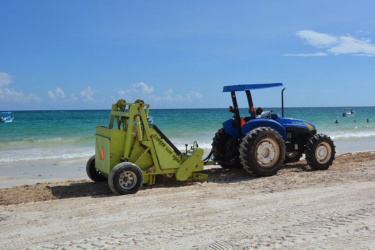
If you arrive and the sand is covered, you have options before writing the day off. Walk a few hundred metres: wrack lines are often patchy, and a stretch in front of a raked hotel can be clear while the next one is not. Swim early, before the day’s new wave arrives, and look at the water as well as the sand, because floating mats near the shore make wading unpleasant even when the beach looks tidy. Keep sandals on if the seaweed is piled, since decaying heaps can hide crabs and sharp debris. Finally, take the photo for your records of the date and place, because it helps if you need to discuss a cancellation policy with a hotel or tour operator.
What authorities and hotels are doing
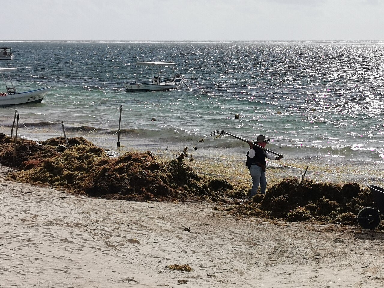
Quintana Roo has been trying to manage the seaweed for years. In July 2026 the federal government announced an integrated programme that includes buying more collection boats to intercept the seaweed at sea, installing barriers, and sending collected material to recycling centres to turn it into energy or construction materials. Hotels and beach clubs often rake daily, and municipal crews work the public beaches.
This helps but does not eliminate the problem. A heavy wave of arrivals can overwhelm barriers and crews in a day. From your side, the practical effect is that beaches that are cleaned regularly recover faster than public stretches without crews.
A short decision checklist
- Flexible dates? Pick November to March, or aim for the first half of the shoulder months.
- Fixed dates in June to August? Book a hotel with a pool, add a cenote day, and keep one flexible day for an island trip.
- Snorkeling is the point? Cozumel’s west coast and cenotes are more reliable than east-facing mainland beaches.
- Travelling with small children or someone with breathing problems? Choose a hotel with a pool and ask how often it clears the beach.
- Two days before departure: Check the NOAA map, the USF bulletin and a recent beach report, then decide which day to put the beach first.
Bottom line
Sargassum is a seasonal reality, not a trip-ender. Expect the heaviest weeks from June through August, expect November through March to be the cleanest window, and expect variation within every month. Check the official risk map and a recent report, keep a cenote or island day as a fallback, and book accommodation with a pool if you will be there in peak weeks.
Frequently asked questions
When is sargassum season in the Riviera Maya?
Roughly April through October, with the heaviest arrivals usually in June, July and August. NASA reported that the Atlantic sargassum belt peaked in June 2026, and USF's outlook in July said amounts should keep falling in the coming months, possibly until November. November through March is typically the cleanest window, but weekly and even daily variation is large in every month.
Is the Riviera Maya safe to visit during sargassum season?
Yes. Sargassum is a nuisance and an environmental problem, not a reason to cancel a trip. Piles of seaweed on the sand can smell as they rot, and they can make swimming unpleasant, so visitors usually switch to cenotes, pools, island beaches or a different stretch of coast. People with breathing conditions should ask their doctor about being near large decaying piles.
Which Riviera Maya beaches get the least sargassum?
Beaches that face north or west, or sit in the lee of an island, tend to fare better than east-facing mainland beaches. Isla Mujeres' Playa Norte and Cozumel's west coast are the usual picks, and cenotes and Bacalar Lagoon are not affected because they are not on the open sea. No beach is guaranteed clean, so check a current report before you commit.
How can I check sargassum before I travel?
Use the NOAA/AOML and University of South Florida Daily Sargassum Inundation Risk map, the monthly USF Sargassum Outlook bulletin, and the Red de Monitoreo del Sargazo at sargazo.info, which lists monitored beaches by town. Combine a satellite or risk map with a beach report posted in the last 24 hours, because conditions can change in a day.
Do hotels clean up sargassum?
Many resorts and beach clubs rake or truck away seaweed daily, and authorities also use boats and barriers. The result is that a beach can look clean in the morning and covered by afternoon after a new wave arrives. Ask your hotel how often it clears the shoreline and whether it has a pool or a fallback beach.
Keep planning
- Cancun Airport to Your Hotel: Every Transfer Option Compared
ADO bus, private transfer, shared shuttle, taxi, or rental car from Cancun airport? We compare cost, time, and hassle, plus how to get past the terminal touts.
Updated Oct 2026 - Cancun to Tulum: Bus, Colectivo, Tren Maya, or Private Transfer
Cancun to Tulum by ADO bus, colectivo, Tren Maya, private transfer or rental car: costs in pesos, travel times, and which option fits your trip.
Updated Oct 2026 - Visitax: Quintana Roo's Tourist Tax for Foreign Visitors Explained
What Visitax is, who has to pay it, where to pay on the official site, and how to avoid copycat sites before a Cancun, Playa, or Tulum trip.
Updated Oct 2026